


Anti Gravity Gear Appalachian Trail Guidebook 2023
3412090114
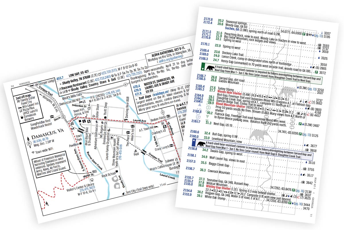
Regular price $17.95Since 2010, The A.T. Guide, a.k.a. The Awol Guide," has been the guidebook of choice for hikes of any length on the Appalachian Trail. The book contains thousands of landmarks such as campsites, water sources, summits and gaps. The trail's elevation profile is included and every landmark is aligned to the profile. Hikers using this guide know where they are on the trail, what views, streams and campsites are ahead, and whether they'll be hiking uphill or downhill to get there. The A.T. Guide answers all of your questions about how to get rides, where to stay, and where to get supplies. There are 100 maps of towns on or near the trail showing where to find these services and detailed listings for businesses. The A.T. Guide is the most innovative trail guidebook ever developed.
Specifications
- 2628 Mile to trail landmarks with point by point cumulative mileage (both NoBo & SoBo) including:
- 1128 Water sources (potentially unreliable sources noted)
- 343 Identified campsites or tent-sites on, or convenient to, the A.T.
- 341 Shuttle services (124 dedicated shuttlers, 217 offer shuttle with stay)
- 259 Shelters include distances to the last three and next three shelters & whether or not there is tent-site, privy, and bear cable (or bear box) access.
- 943 Service listings listed in order of distance from the trail including
- 1099 Short awol.site URLs for service listings
- 437 Lodging services (hostel, hotel/motels, and B&Bs)
- 320 Resupply points (grocers, convenience stores, and outfitters)
- 293 Parking areas with GPS coordinates
- 162 Post offices with hours of operation & phone numbers
- 100 Maps (for towns, areas, and difficult trail intersections) including
- Countless additional services not included in full text listings
- Major road and trail crossings
- GPS Coordinates & location based magnetic declination
- 240 Color Pages, digital pdf file featuring
- 47 Custom icons for identification of services at a glance
- Important information from state parks and trail maintaining clubs
- Invaluable safety and best practices information
- Plastic seal top bag
